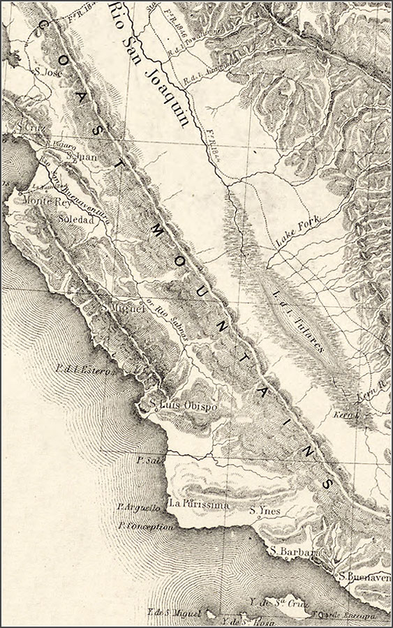
[Detail] Map of Oregon and upper California from the surveys of John Charles Frémont and other authorities / drawn by Charles Preuss under the order of the Senate of the United States ; lithy. by E. Weber & Co., Balto.
Frémont, John Charles, 1813-1890.
CREATED/PUBLISHED
Washington : The Senate, 1848.
NOTES
Scale 1:3,000,000.
Hand colored.
Relief shown by hachures and spot heights.
Shows area of U.S. west of the Continental Divide.
Includes notes and “Profile of the travelling route from the South Pass of the Rocky Mountains to the Bay of San Francisco.”