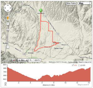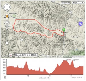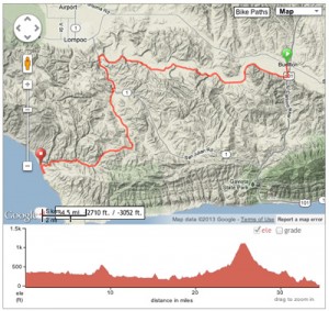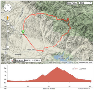
rolling Happy Canyon leads to Figueroa Mountain’s burly 4,022 foot climb
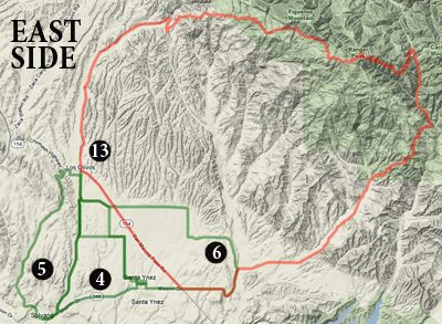
Eastside KEY
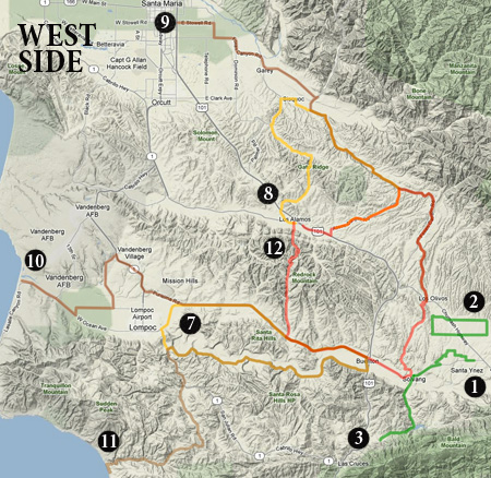
Westside KEY
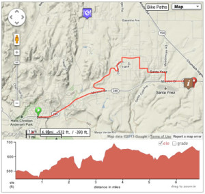
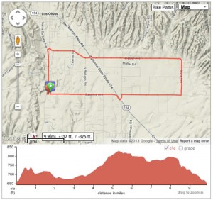
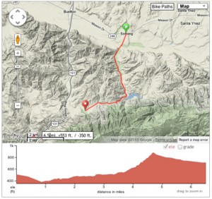
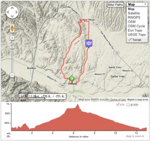
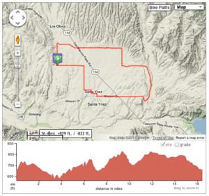
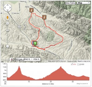
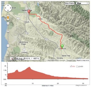
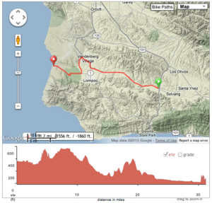
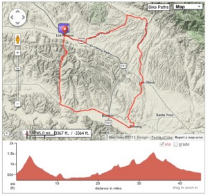
To view these routes in geographic context and for a numerical key to this index, click the thumbnail maps to the right.
When cycling, keep in mind:
- Pack layers if the weather threatens instability.
- Check weather conditions: December to April is the rainy season.
- Beware of busy times for wine tasting drivers on the road.
- Exercise good tasting room etiquette, especially if traveling by bike.
![]()
Select Map > Terrain for topographic details.